Flow Monitoring, Rain Gauges and High Water Sensors
Arlington County is working to develop an expanded rainfall and stormwater flow monitoring program.
The goals of the program are to: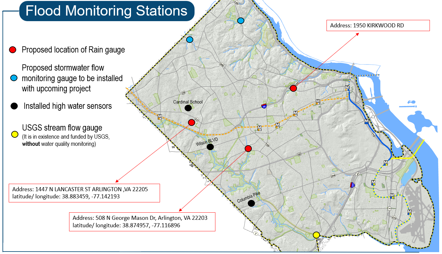
- Better understand why and where it floods in the County,
- Improve and calibrate the County’s hydrologic models, and
- Monitor, analyze and collect rainfall data to assess climate changes occurring in the County and the impact on infrastructure.
The map to the right shows the locations of existing USGS stream flow gauge, the locations of installed high water sensors, and proposed locations for new rain gauges and new stormwater flow monitoring gauges (that will be installed as part of a culvert replacement project).
NVRC Regional Rain Gauge Platform
The Northern Virginia Regional Commission, of which Arlington is a member, has created a regional rain gauge map providing access to real time precipitation from multiple sources in the region. This cooperative effort was made possible through Virginia’s Community Flood Preparedness Fund (CFPF), the Regional Greenhouse Gas Initiative (RGGI) and NOAA through FY23 U.S. Senate Appropriations.
View interactive rainfall map
High Water Sensors
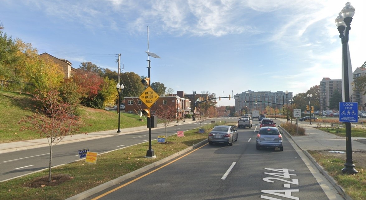
High water sensors were installed in intersections with higher flooding risk, including Wilson Blvd where it crosses Four Mile Run, Columbia Pike and Greenbrier St. A sensor is also proposed for installation at Kirkwood Rd, another location with elevated flood risk. These high-water sensors include a sign and flashing alert for drivers of the flooded conditions before they enter the intersection. Flow sensors are also installed inside the stormwater vault at Cardinal Elementary school.